January, 2018
If you’re a diver who loves history, then St.Eustatius (called “Statia”) is THE place to go in the Caribbean. It has been said that the island has more Colonial Period History per mile- above and below water- than anywhere else in the New World. And new finds are continually being uncovered. This has earned it the nicknames of the “historical gem” and the “Pompeii of the New World”. But Statia also has a dark history. It was a major slave trading center, and its local economy once thrived on slave labour. One trip won’t be enough to fully absorb all the fascinating history, archaeology, hiking, wrecks and marine life that this island boasts.
The Historical Background:
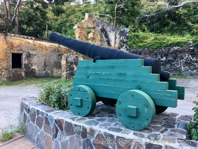
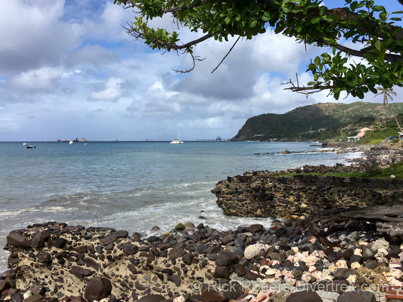
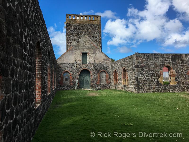
You’ve probably never heard of St. Eustatius (“Statia”) before. It’s a small, sleepy island in the Eastern Caribbean that measures only about 8 km by 4 km at its widest points. Yet two and a half centuries ago, everyone knew about Statia. Its position in the trading routes, large safe harbour, and free trade practices (to an extreme!) made it the richest trading center in the Caribbean, and the busiest port in the world. For this reason it was once called the “Golden Rock”. Most people in the New World had consumed goods that at some point had passed through the island’s bustling port. But there was a dark side to all that success. The island was a major transit harbour for slaves. Slaves were also utilized as crewmen on the ships, as ship workers, for transporting goods to and from ships, and on their plantations.
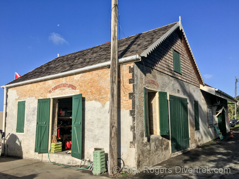
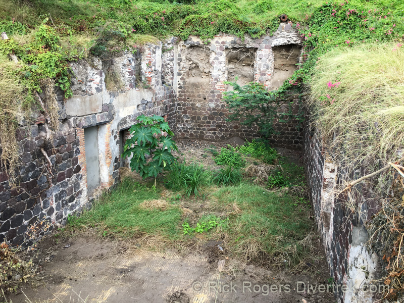
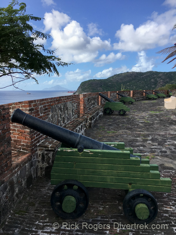
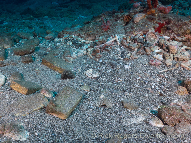
During the island’s economic peak in the late 18th century almost 20,000 people-sailors, slaves, merchants, and plantation owners- were packed onto this tiny island. Over 3,500 merchant ships per year dropped anchor here at its peak, and more than 500 shops and warehouses lined its shore. The crumbling remains of these buildings still line the shore and the main road through Lower town. And in the water, many dive sites contain man-made artifacts that bears witness to all this activity.
But by the end of the 1700’s Statia’s importance as a trade center was in decline. The U.S. was now free and independent and trade with neighboring islands decreased. Free trade in slaves was abolished on Statia by 1784, and the end of slavery was insight.
Today Statia has a population of about 4,000 and it’s main employers are an oil depot at the North end of the Island, and tourism.
The Diving:
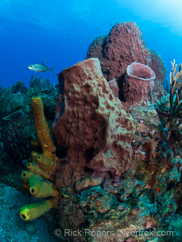
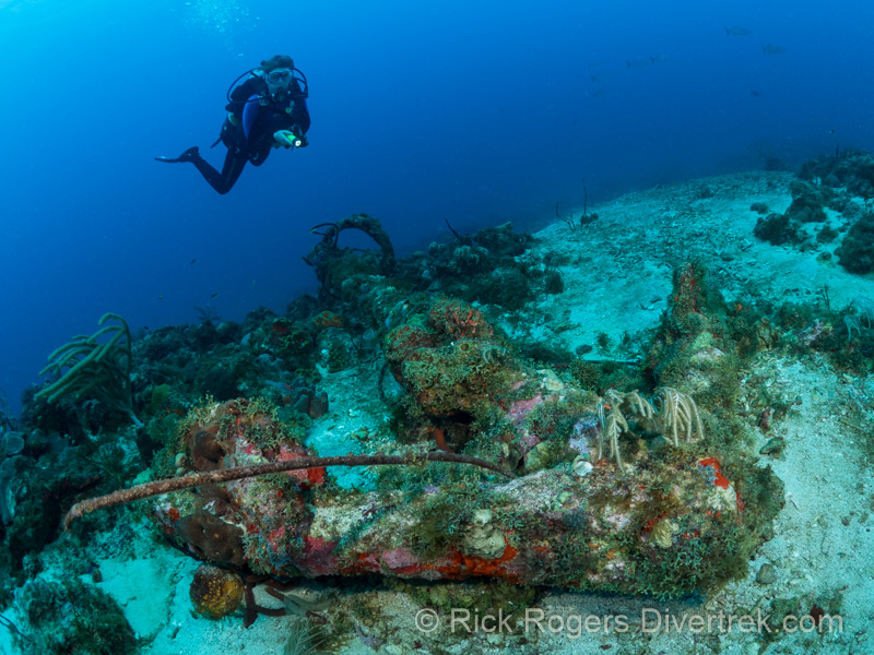
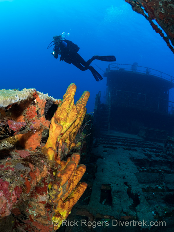
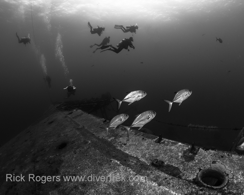
For such a small island, Statia has a surprising diversity of diving: wrecks, walls, reefs, lava flows, and “muck” diving. But bear in mind that when you hear “wreck” diving as used in the historical context here, it will take some imagination on your part! Over the centuries since their sinking, all of the wood has long since rotted away. The only thing that often remained was their ballast stones, which were quickly colonized and cemented together by calcareous corals before the wood completely rotted. This was then overgrown with layers of others coral and sponges transforming it into what you see today-patch reefs, roughly in the shape of a ship’s outline. This in turn has attracted loads of marine life.
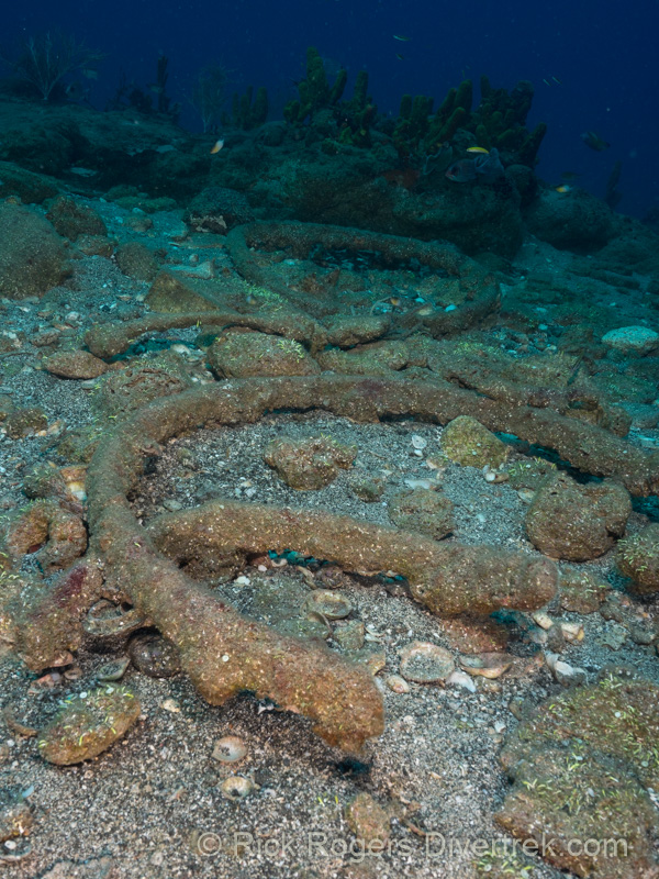
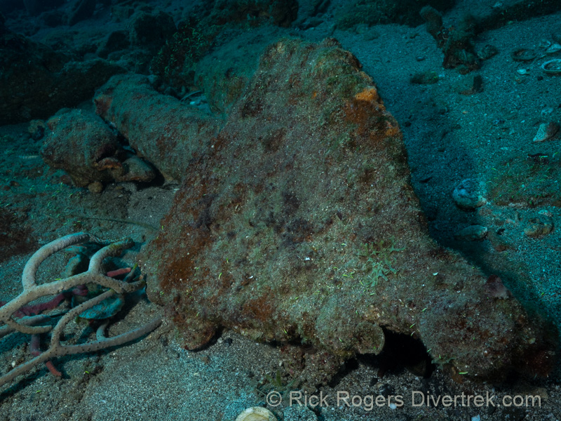
The following three photos were from a single dive at the Double Wreck dive site (depth about 55-60′):
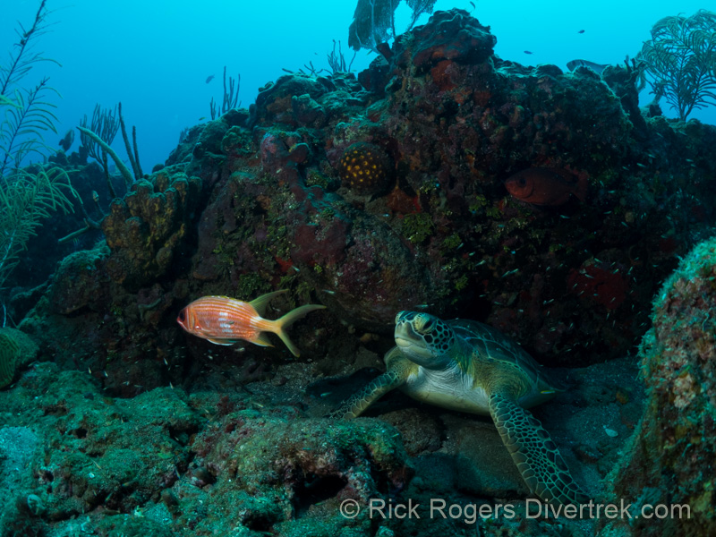
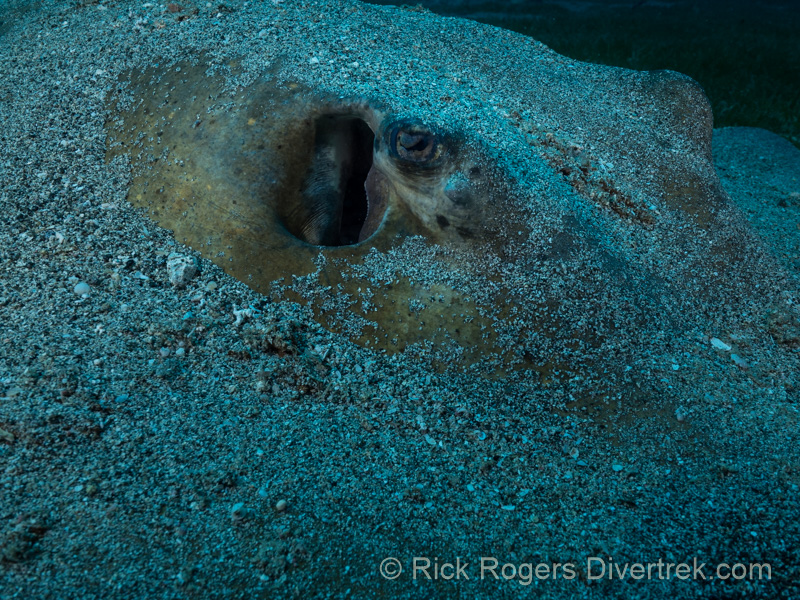
Hurricane Irma, which side-swiped Statia about 3 months prior, did some damage to the corals and wrecks. However it did uncover a lot of artifacts that had long since been buried. At Triple Wreck dive site (50-60′ depth), we hardly got anywhere because we were so mesmerized by the artifacts, and stingrays, that we initially saw. Most of the artifacts that you will see date to Statia’s “Golden Era” in the later half of the 18 century. Because there are so many artifacts here, all of the diving at Statia is accompanied by divemasters, to maintain site integrity.
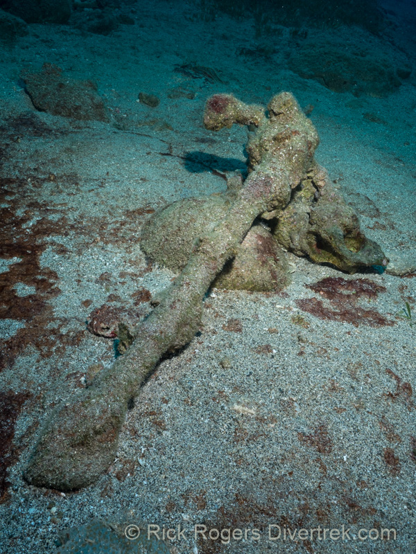

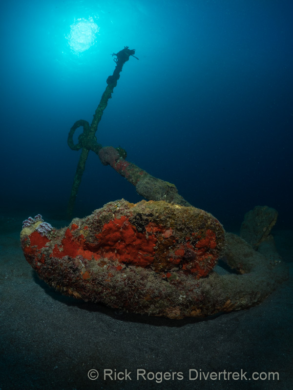
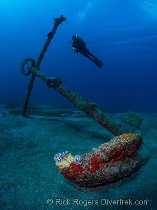
The Lost Anchors dive site is an advanced, negative-entry dive that lies about 2 miles (3 km) offshore, with it’s deepest point at about 85′ to the sand. This patch reef is thought to have its origins from a shipwreck, as it can’t be explained in any other way. The two large anchors that we saw (there are five) were set into a very nice reef, filled with barrel sponges, tube sponges, and rope sponges. There’s lots of marine life here: we saw a large Green Moray, two Hawksbill turtles, schools of Jacks, and a beautiful juvenille Queen Angelfish under a ledge.

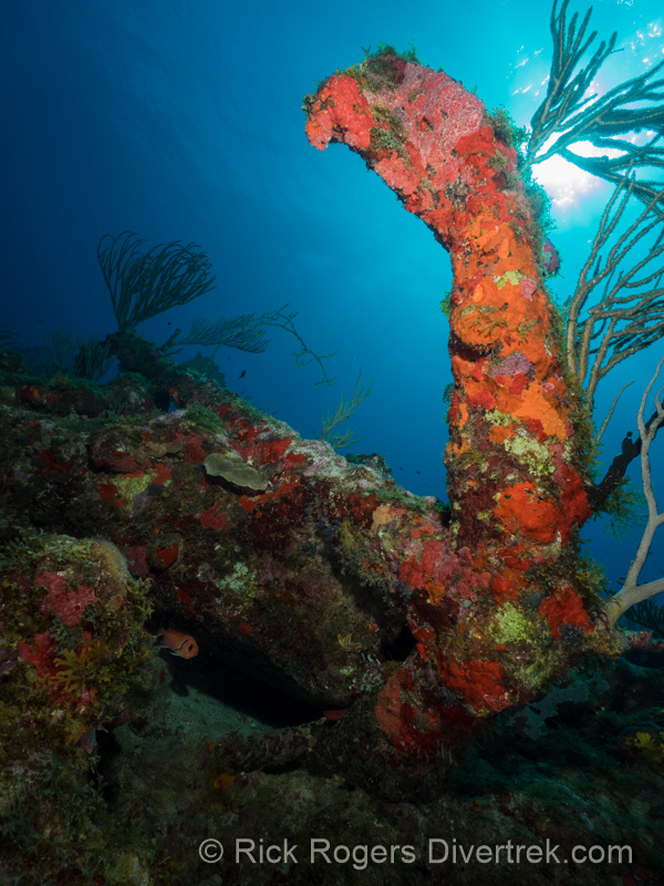
Anchor point dive site (depth about 60′) is named after the anchor that was caught under the ledge of a lava finger. This is probably the most aesthetic anchor that I saw here. The red and orange corals on it contrast strongly with the blue water, and make it look like it’s on fire!
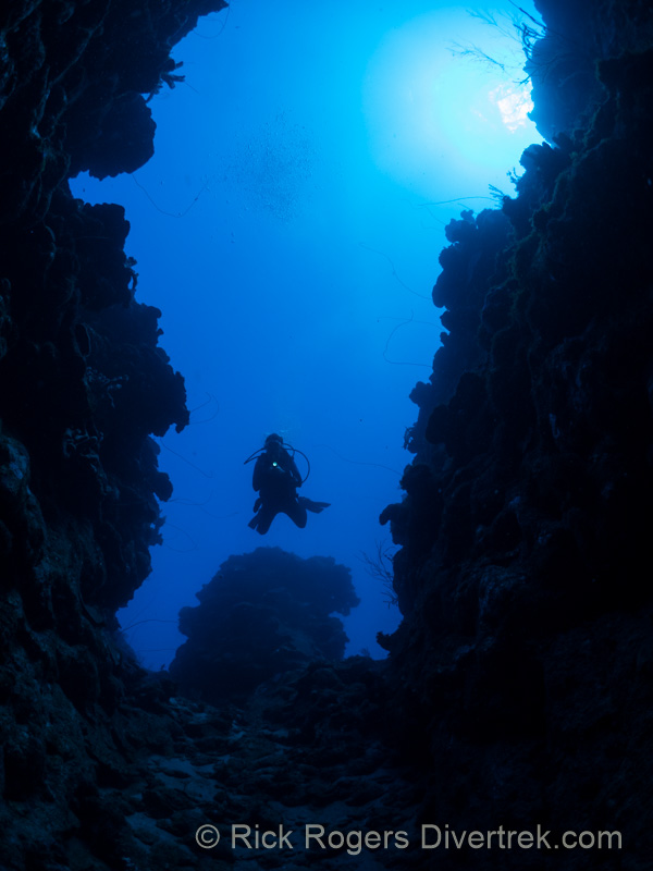
The Grand Canyon dive site makes for a dramatic dive. You’ll feel like your flying through a mini-Grand Canyon. This is a deep dive, potentially to 130+ feet, but you can choose to stay shallower on top of the pinnacles. The walls of the canyon are actually lava flows that have become encrusted with corals, including black corals. As you exit out the canyons at 130′, and round the corner to begin your ascent you will encounter fields of large Deep Sea Gorgonians.
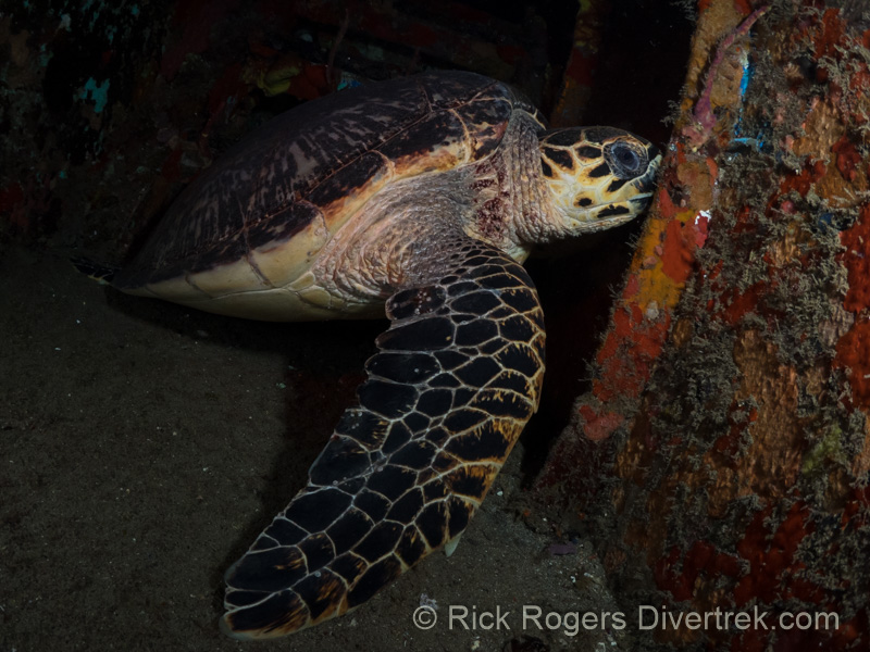
The Chien Tong Wreck is a 170′ (52 m) long former Tiawanese Long-liner. The ship struck an object in port which severely curled the keel line at the bow (take a close look!), and the insurance company refused to insure it. It now finds new life as an artificial reef at a depth of 70′. Since the ship has been down for a couple of decades, it is encrusted with a lot of Sea Fans and colorful sponges. This is a must do night-dive, and one of the best I’ve ever done in the Caribbean. Count on seeing many massive Hawksbill and Green turtles (3ft across) that use it as a “hotel” for the night. I also saw a large Porcupinefish (3ft), Angelfish, crabs, opened Basket Stars on the railings, and Spanish Slipper lobsters in the sand at the bottom.
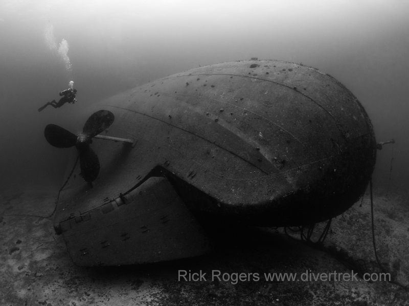
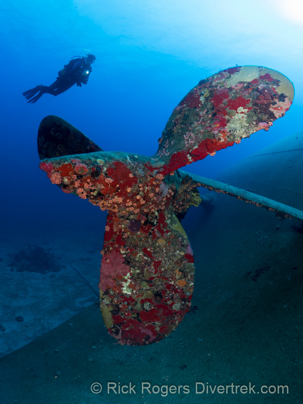
The Charles L. Brown wreck is one of the largest wrecks in the Caribbean at 327′ (100 m), about double the size of the Chien Tong. You’ll be awe-struck by the size of this ship as you descend down the line, like you’re staring at a giant sleeping beast. The Brown is a former cable laying ship that was named after the CEO of AT&T, ans was sunk in 2003 as an artificial reef for divers. But unfortunately, a burst pipe several days before its intended sinking which sent it to the bottom with a heavy list. It now rests in 102′ (31 m) of water on its Starboard side. The wreck is now patrolled by large schools of Horse-eye Jacks, and I even saw several large Caribbean reef sharks encircling its perimeter. Unfortunately, Hurricane Irma damaged some of the superstructure at the bow that was encrusted with sea fans that I so badly wanted to photograph. Make sure you ask for more than one dive on this wreck!
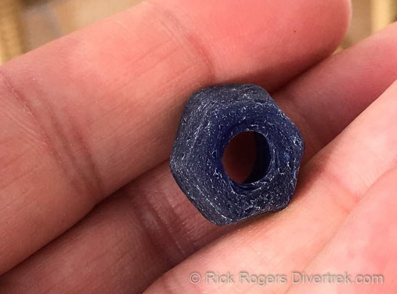
Make sure you also do at least one dive at Blue Bead Hole dive site. It’s a “muck” dive (sand & grass beds) in about 55′ of water. This is where you can find the much sought after Blue beads. But according to the legend, they find you, and you belong to Statia and will return. Blue beads were a form of trading currency that the Dutch used, and can be found anywhere the Dutch traded-to acquire slaves in West Africa, Ivory, Gold or other goods. They were manufactured in Holland by a glass manufacturer and sent overseas by the boat load. But on Statia the slaves were paid with this currency and were able to purchase items with it-even a wife!
It has been said that the slaves through them into the water to celebrate their freedom when slavery ended in 1863. However this doesn’t explain the relatively large quantities that lie offshore beyond throws reach. The original source of these Blue beads is thought to be from a shipwreck at nearby Crook’s reef, which was carrying a cargo of them bound for Africa. The local Statians related this to an American traveller, Frederick Fenger, when he himself found one in 1907. He was told that the ship had been down for a century or more at that time. He published an account of his travels a decade later in “Alone in the Caribbean”, 1917. (personal correspondence, Ruud Stelten)
Wave action and storms (especially hurricanes, like Irma) uncover them to this day. About a hundred lucky divers find these beads every year, and its the only artifact that you are allowed to take home with you. If you go, stay a good meter off the bottom so as to give you maximum view of the bottom when searching. Other divers that I had talked to who had found multiple ones, including previous trips, had good luck looking for them at the edges of the grass beds. Once a symbol of oppression, many people now proudly wear them on necklaces to celebrate freedom and a connection to the island.
Tips:
This is a very safe and quiet island, with friendly people. Goats and chickens wander the streets without worry of being hit by cars. You won’t find the tourist traps and junky souvenir shops of the other mass-tourism destinations. No cruise ships dock here, nor will they ever.
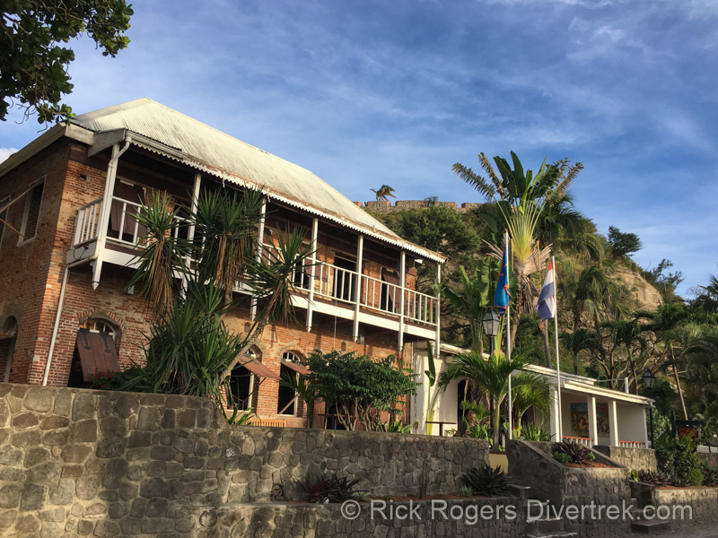
I can easily recommend staying at the Old Gin House. You won’t need to rent a car, as most things are within walking distance. The rooms are spacious, with lots of storage, and have a mini-fridge. The only small complaint that I might have is that the WiFi reception is very spotty and at times unpredictable. Their outdoor restaurant includes a very hearty breakfast that won’t leave you wanting, and its nestled in a peaceful ocean view setting. There are also other restaurants within walking distance if you’d like to change it up.
It’s a good idea to leave yourself some flexibility and book two dives per day with the option to add a third. This leaves you with more time to explore the town and the other attractions. Plus there are tight turn-around times to make the afternoon dive (1 hour at most), which means there is not enough time to go to a restaurant for lunch. The Old Gin house offers a packed $20 sandwich lunch to save time, but I preferred the more frugal approach and made my own. There is a grocery store (Dugan’s Grocery Mart) only a 10 minute walk away at Upper Town from which you can buy your groceries, and other beverages.
If you want to hike the Quill Crater to the peak of the rim, leave at least a half-day and take at least 1 L of water per person. This is a bit of a gnarly hike (using ropes to pull yourself up at one spot), so wear appropriate footwear. To save time, and energy, take a taxi to the park entrance. There are other easier, and longer distance trails that you could choose. A rainforest actually exists within the crater.
References:
An indispensable guide for the history of Statia and its archaelogy is Ruud Stelten’s “Relics of a Forgotten Colony: The Cannon and Anchors of St.Eustatius” (MA Thesis ). He is an archaelogist with SECAR (St.Eustatius Center for Archaeological Research), and presently a PhD candidate at Leiden University.
https://openaccess.leidenuniv.nl/handle/1887/18849
I am indebted to Ruud for cheerfully and generously answering all my many questions about the history and artifacts at Statia.